EXTREMELY RARE J. H. Colton 1856 Folded Pocket Map Kentucky Tennessee NOT Atlas


Item History & Price
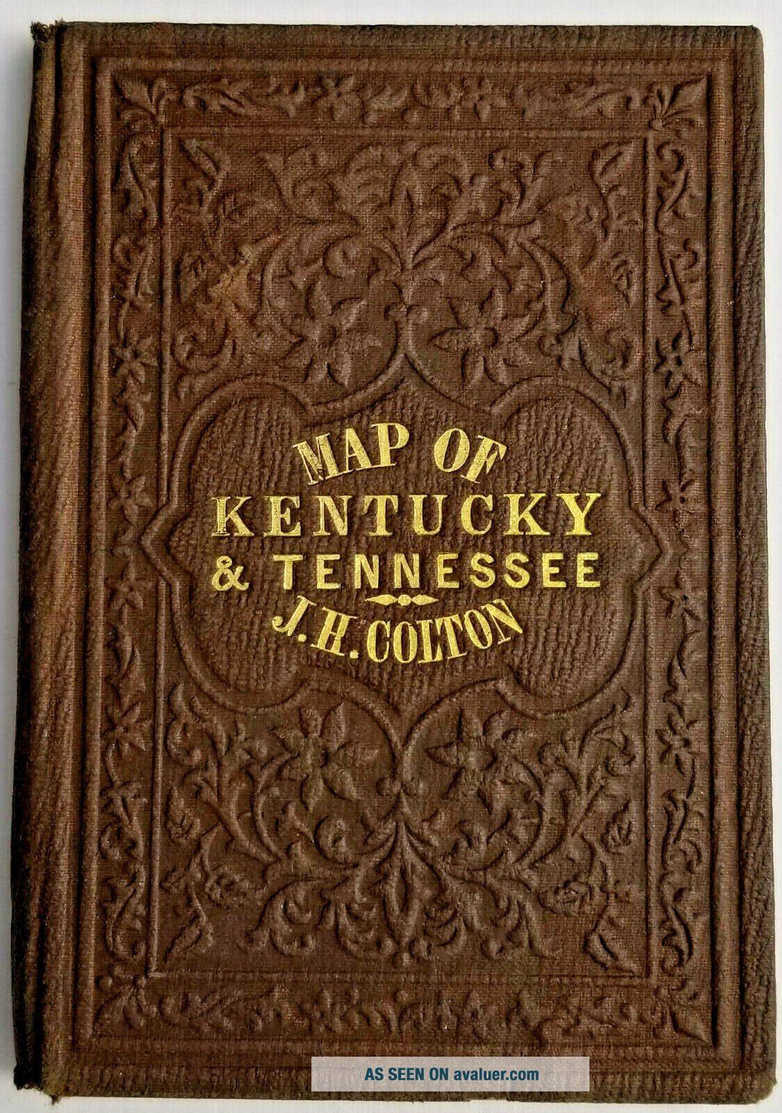
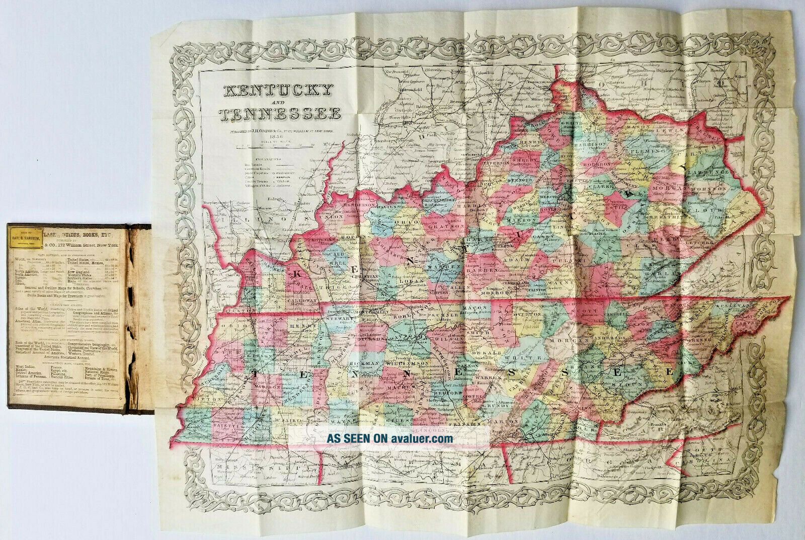
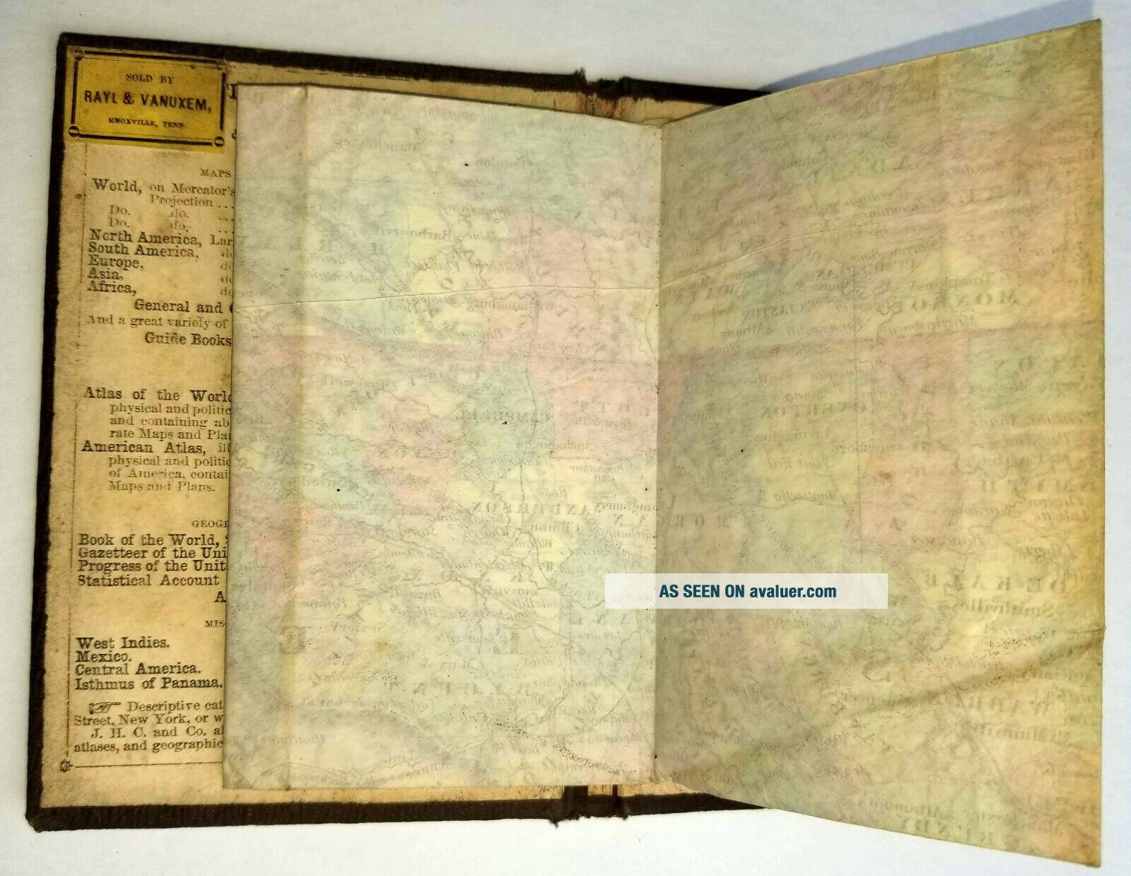
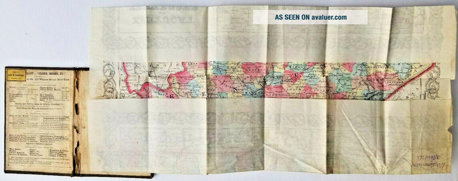
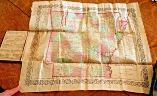
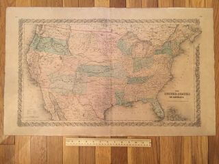
This listing is for a folded traveler's map, sometimes known as a "pocket" map. It is entitled Kentucky & Tennessee, with the publisher identified as J. H. Colton & Co., No 172 William St., New York, and the date of 1856.
We have been unable to find examples of this exact map in the U. S. Library of Congress or other antiquarian map collections on-line. The only Kentucky & Tennessee map by Colton we identified from this time period is from a two-volume at...las.
Joseph Hutchins Colton (July 5, 1800 – July 29, 1893) founded an American map-making company that was an international leader in the map publishing industry between 1831 and 1890.
Traveling maps of this era were printed on banknote paper, using engraved steel plates. The maps had decorative borders and were hand-colored. The listed map contains multiple colors to identify counties, boundaries, and other features.
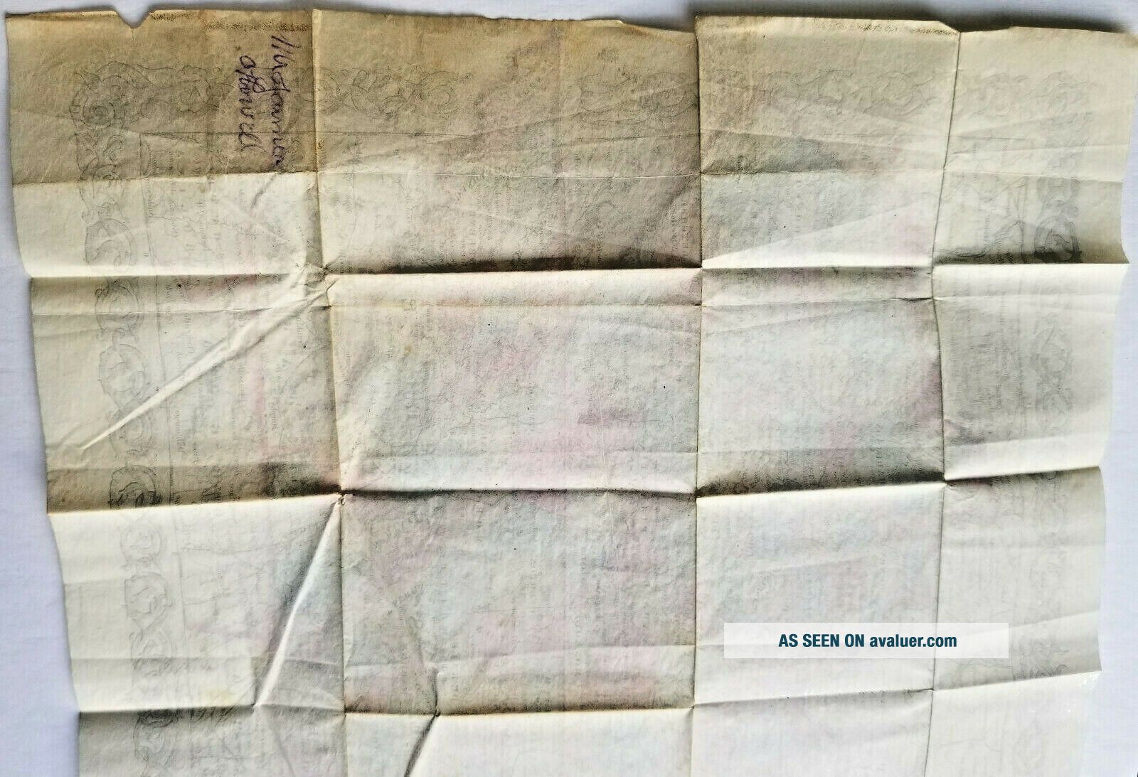
The item listed here is in extremely good condition, with the exception of some paper loss at edges of endpapers on the cover, fabric damage to the interior hinge, foxing and smudging, random creasing other than the intended folds, and small areas of separation at corners.
Unlike most pocket maps, this item seems to have been seldom used. It does not have the expected damage from insertion and removal from pockets, bags, and saddlebags, nor does it seem to have been unfolded very many times. The creases are crisp.
Closed, the map booklet's size is 5" x 3.5", approximately 3/8" thick. Folded open, the map itself is approximately 16.75" x 13.5".
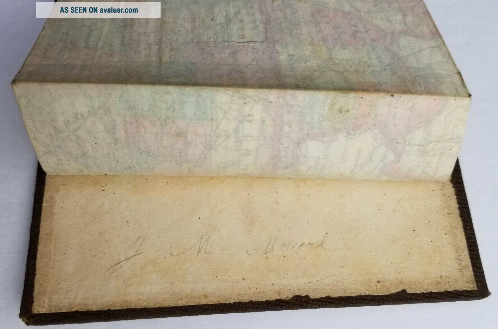
The exterior covers are embossed and appear to be a combination of leather and fabric. The covers have very little wear, primarily at the top and bottom of the spine, and the gilt letters on the front are clear. The map remains tightly glued into the covers.
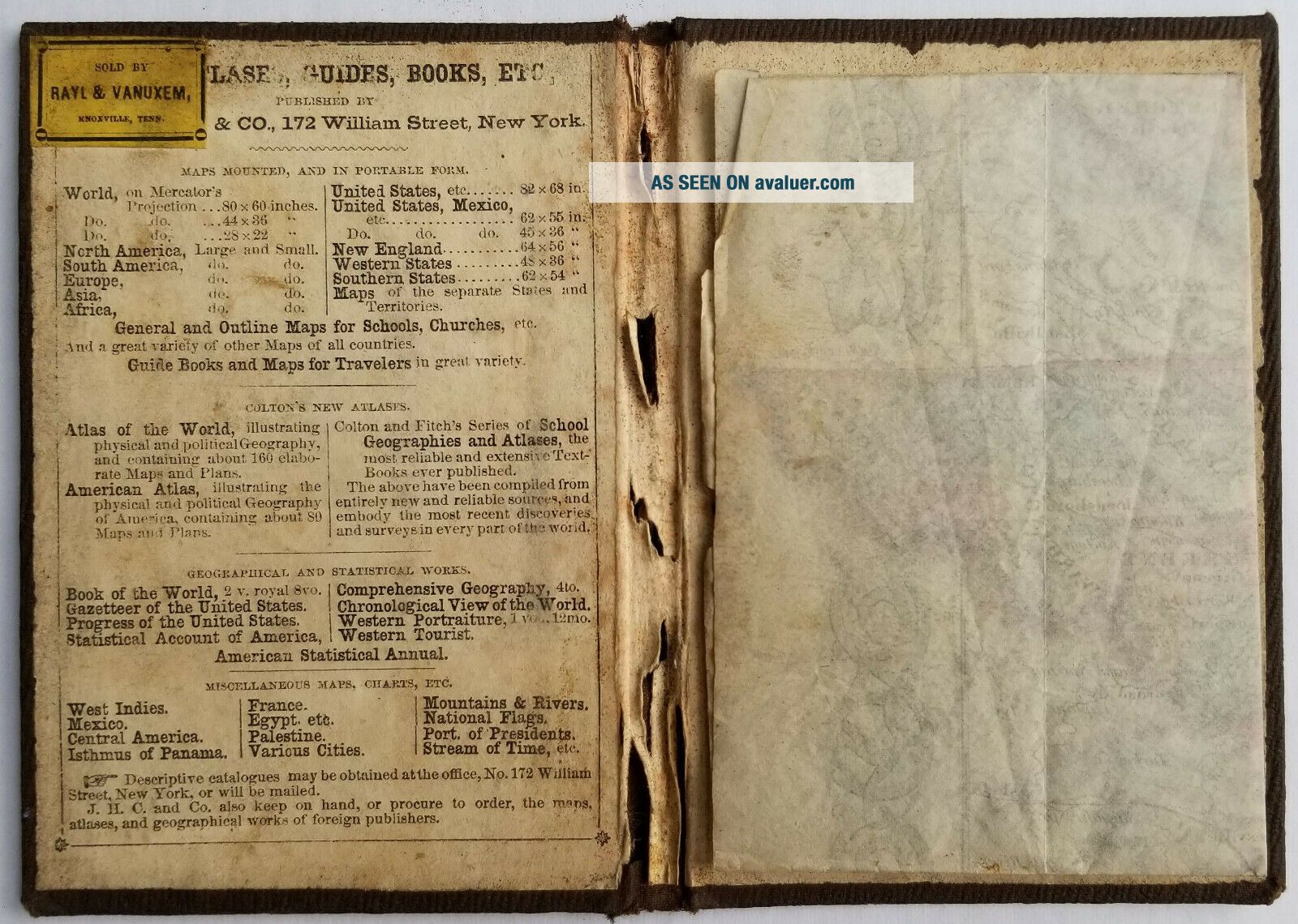
This map has the added feature of the seller's tag adhered inside the front cover: Rayl & Vanuxem, Knoxville, Tennessee.
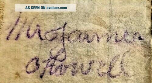
The map's recent provenance is from the personal collection of a well-known East Tennessee historian, who acquired the map from the estate of a deceased East Tennessee attorney. The map was stored with his practice files for decades. Two individuals' names, both difficult to decipher, are written on the item. One is in pencil inside the back cover on the endpaper. The other is on a corner of the back of the map itself. The handwriting of both names is contemporary for mid-to-late 19th Century.
The item was authenticated by an expert antiquarian map appraiser.
Please look carefully at the photos. eBay limits sellers to 12 photos per listing, but we can provide additional images upon request.
We have been unable to find examples of this exact map in the U. S. Library of Congress or other antiquarian map collections on-line. The only Kentucky & Tennessee map by Colton we identified from this time period is from a two-volume at...las.
Joseph Hutchins Colton (July 5, 1800 – July 29, 1893) founded an American map-making company that was an international leader in the map publishing industry between 1831 and 1890.
Traveling maps of this era were printed on banknote paper, using engraved steel plates. The maps had decorative borders and were hand-colored. The listed map contains multiple colors to identify counties, boundaries, and other features.
The item listed here is in extremely good condition, with the exception of some paper loss at edges of endpapers on the cover, fabric damage to the interior hinge, foxing and smudging, random creasing other than the intended folds, and small areas of separation at corners.
Unlike most pocket maps, this item seems to have been seldom used. It does not have the expected damage from insertion and removal from pockets, bags, and saddlebags, nor does it seem to have been unfolded very many times. The creases are crisp.
Closed, the map booklet's size is 5" x 3.5", approximately 3/8" thick. Folded open, the map itself is approximately 16.75" x 13.5".
The exterior covers are embossed and appear to be a combination of leather and fabric. The covers have very little wear, primarily at the top and bottom of the spine, and the gilt letters on the front are clear. The map remains tightly glued into the covers.
This map has the added feature of the seller's tag adhered inside the front cover: Rayl & Vanuxem, Knoxville, Tennessee.
The map's recent provenance is from the personal collection of a well-known East Tennessee historian, who acquired the map from the estate of a deceased East Tennessee attorney. The map was stored with his practice files for decades. Two individuals' names, both difficult to decipher, are written on the item. One is in pencil inside the back cover on the endpaper. The other is on a corner of the back of the map itself. The handwriting of both names is contemporary for mid-to-late 19th Century.
The item was authenticated by an expert antiquarian map appraiser.
Please look carefully at the photos. eBay limits sellers to 12 photos per listing, but we can provide additional images upon request.


![[super Rare ] J. H. Dallmeyer 3b 23518 June 11, 1867 Patent Portrait Camera Lens](https://pic.avaluer.net/imgstmb/a/q/p/c/d/-super_rare__j___h___dallmeyer_3b_23518_june_11__1867_patent_portrait_camera_lens-1_26_tmb.jpg)